


Lake Wentworth and Crescent Lake
Russ Schundler Video
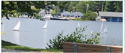
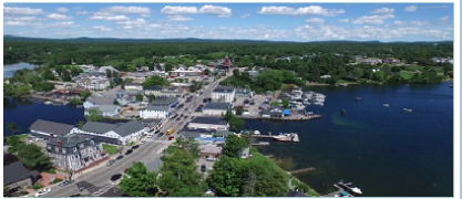
Lake Wentworth is the largest lake entirely within the boundaries of Wolfeboro. Earlier it was called Smith’s Pond, named after the well known colonial governor of New Hampshire. Depending upon who is counting, Lake Wentworth has 19, 20, or 21 islands, more or less, the largest of which at about 90 acres and measuring nearly a mile long from east to west is Stamp Act Island. Comprises about 15 miles of shoreline surrounding about 3,037 acres (about five square miles) of water surface.
Lake Wentworth is fed by brooks of varying size, named as follows, in clockwise order beginning at the Smith River outlet: Harvey (or Hooper), Tyler (earlier Hersey), Fernald, Willey (called Willey’s Mill Stream at the turn of the 20th century), Clay Pit (or Frost), Ryefield, Warren, Townsend, Red, and Heath. Then there is Whitton Brook, tiny and omitted from most maps. (Courtesy of David Bowers)
Statistics (Wentworth + Crescent)
| Watershed Area | 35.6 sq. miles | Max Depth | 80 ft. |
| Surface Area | 3018 +147 acres | Mean Depth | 25 ft. |
| Shore Length | 20 + 4 miles | Volume | 73,997,266 + 1,814,665 cubic meters |
| Elevation | 534 ft. |
Wentworth Watershed Association Web Site
| Most Recent Water Quality Reports |
|---|
| Site 1, Fullers |
| Site 2, Triggs |
| Site 12, Governors |
Wolfeboro Waters Water Quality Summary for Lake Wentworth and Crescent Lake